
Easily embed the windy.com widget as a native WordPress widget or shortcode.
| Author: | David Matthew (profile at wordpress.org) |
| WordPress version required: | 5.0 |
| WordPress version tested: | 6.5 |
| Plugin version: | 1.5.0 |
| Added to WordPress repository: | 10-08-2019 |
| Last updated: | 20-03-2024 |
| Rating, %: | 98 |
| Rated by: | 11 |
| Plugin URI: | |
| Total downloads: | 19 867 |
| Active installs: | 3 000+ |
 Click to start download |
|
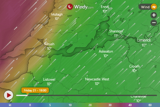
Ventus allows you to easily embed the windy.com widget on your website, in the form of a native WordPress widget (accessible from Appearance > Widgets) or as a simple shortcode.
It is a lightweight plugin built using an object-oriented approach, and follows WordPress Coding Standards.
Features
- Set the overlay to either clouds, CO concentration, currents, radar/lightning, rain, sea temperature, snow cover, standard temperature, waves, wind or wind gusts.
- Use either Celsius or Fahrenheit as the temperature scale.
- Set the width, height and border-radius using responsive (%) and/or fixed (px) values.
- Manually define longitude and latitude for precise location coordinates.
- Select the altitude from surface up to 13.5km (effective only when layer is set to wind or temperature).
- Choose from 8 levels of zoom (min. 3, max. 11).
- Show or hide pressure isolines, the map marker and spot forecast.
- Choose from the following wind measurement units: beaufort (bft), kilometers per hour (km/h), knots (kt), meters per second (m/s) and miles per hour (mph).
- Choose from the following forecast models: ECMWF, ICON, ICON-EU, GFS and NEMS.
- Set the forecast time from now to 12 or 24 hours ahead.
Shortcodes
The shortcode accepts up to 16 attributes. You can simply use [ventus] and it will work (or the old shortcode [weather-map] which will continue to work), but you will most likely want to customise the remaining attributes yourself.
An example of a fully filled-out shortcode would be:
[ventus width="100%" height="350px" radius="20px" loading="lazy" lat="53.199" lon="-7.603" zoom="4" layer="wind" level="surface" scale="C" units="knots" pressure="true" marker="true" model="ecmwf" forecast="true" time="12"]
The attributes can be set as follows:
- The
widthattribute accepts any valid CSS property for width. - The
heightattribute accepts any valid CSS property for height. - The
radiusattribute accepts any valid CSS property for border-radius. - The
loadingattribute accepts either lazy or eager. The default is lazy loading. - The
latattribute must contain a string of digits to three decimal places, in the range of -90 to +90 (e.g. “53.199”). - The
lonattribute must also contain a string of digits to three decimal places, in the range of -180 to +180 (e.g. “-120.894”). - The
zoomattribute must contain a number between 3 and 11 (inclusive). - The
layerattribute accepts the following values: clouds, cosc (CO concentration), currents, gust, radar, rain, snowcover, sst (sea temperature), temp (standard temperature), waves and wind. - The
levelattribute (only effective when the layer is wind or temp) accepts the following values: surface, 100m, 950h (600m), 925h (750m), 900h (900m), 850h (1500m), 800h (2000m), 700h (3000m), 600h (4200m), 500h (5500m), 400h (7000m), 300h (9000m), 250h (10000m), 200h (11700m) and 150h (13500m). - The
scaleattribute accepts either “C” or “F”, defining Celsius and Fahrenheit respectively. - The
unitsattribute accepts the following values: bft (beaufort), km/h (kilometers per hour), kt (knots), m/s (meters per second) and mph (miles per hour). - The
pressureattribute can be set to true to display pressure isolines, otherwise the isolines will remain hidden. - The
markerattribute can also be set to true, otherwise it will remain hidden. - The
forecastattribute can be set to true to display the spot forecast, otherwise it will remain hidden. - The
timeattribute accepts the following values: now (the default), 12 (12 hours from now) and 24 (24 hours from now). - The
modelattribute accepts the following values: ecmwf, icon, iconEu, gfs and nems.
Note that in the case of an invalid value, a default value will be used instead.
Screenshots
FAQ


ChangeLog